Meet the Faces: Luke Iverson
Maps are a critical part of The Land Trust’s conservation work. Insightful, accurate maps not only enable us to better protect already-conserved land but also help us better identify opportunities to protect valuable land facing critical threats.
Let’s meet Luke, The Land Trust’s Conservation GIS Manager, and take a behind-the-scenes look at how mapping impacts our work.
Luke Iverson started with The Land Trust as a member of the fundraising team four and a half years ago. Having been raised in the cattle business, Luke’s passion for land conservation grew from many trips out west to help at the family ranch.
In Luke’s words: “My childhood – growing up around wide, open spaces and productive land – is a huge part of why I have a land ethic. We also did a lot of camping and hiking along the way every year.”
While at The Land Trust, Luke began taking online courses after hours, quietly honing his map-making skills and expanding his knowledge of various tools, databases, and techniques. So when a position opened for Land Protection Coordinator, Luke saw the opportunity to apply his training and put his hand up to take on the role.
Q: How did you get into mapping?
A: I’ve always been a ‘map enthusiast’ – it’s in my blood. I used to sit with my grandfather every day to look over the section maps of our ranch and nearby areas to plan out the day’s work.
As I grew older, one of my favorite things to do was look at atlases full of back-country road maps to explore and go hiking. Online platforms like Google Maps began taking off, and I thought it was the coolest thing and always wondered how I could get involved. When I saw the direct connection between conservation and mapping at The Land Trust, I jumped right in.
Q: How does The Land Trust use maps to both support and further its conservation work?
A: There’s a legal obligation to know exactly what we are protecting. We will always need maps that are basic yet critical to what we do – maps that both show us where a property is and what it looks like and help identify the land’s conservation values.
Mapping in the modern era is about visualizing data. You can attach just about any kind of data to coordinates on a map, such as population density or endangered plant and animal habitats. By seeing where particular attributes are centralized, we can use this information for long-term planning, forecasting where our work is going to be most necessary.
Q: What recent advancements in mapping do you believe will benefit conservation the most?
A: There are so many tools now that aren’t strictly GIS- (geographic information system) related or for the sole use of mapping professionals – there are programs that can consolidate all sorts of data into one web-based tool.
The South Cumberland / THRIVE 2055 Collaborative Comprehensive Conservation Plan tool that we are involved in is a great example of this – it combines data from multiple conservation groups, government organizations, and national databases into an easy-to-use program that allows groups to identify conservation values in the tri-state (TN/AL/GA) region with minimal prior knowledge of mapping software.
It’s kind of amazing what’s possible using a simple, web-based tool that not long ago wouldn’t have been possible without a team of mapping professionals taking months to crunch gigabytes of data. These tools are helping organizations better connect people to their local communities.
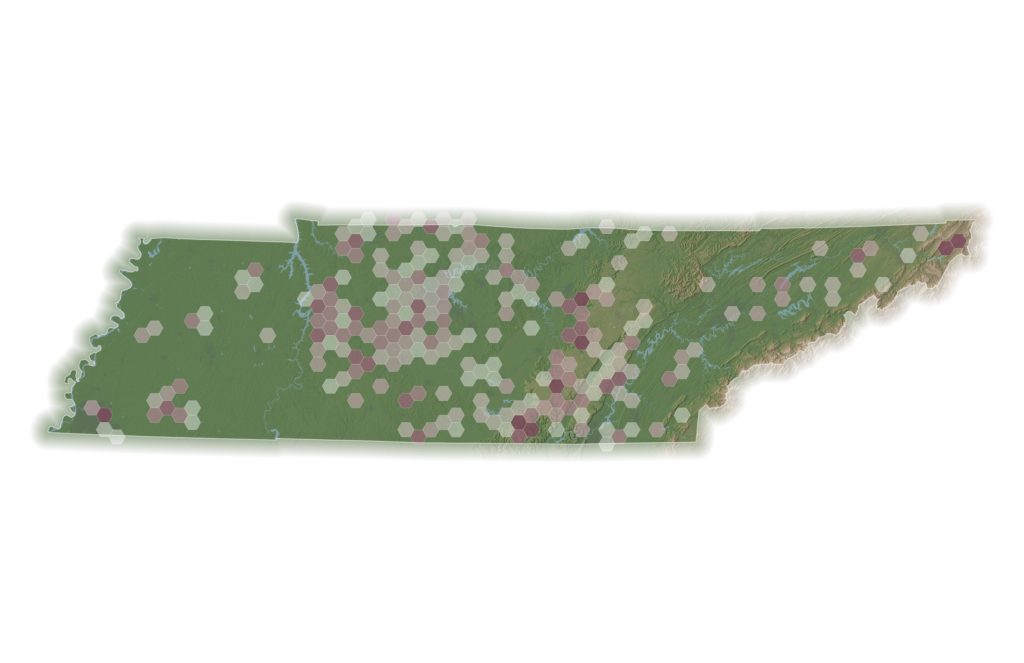
©The Land Trust for Tennessee
Q: What is one of the most interesting maps you have created?
A: I recently created an agricultural map showing all the prime soils, cropland, and pasture in Tennessee to help visualize where the most productive working agricultural land is – a fairly simple map, but I was surprised to see several areas where prime soils weren’t being explicitly used for agriculture.
It’s always interesting to use overlapping features to gain insight from a particular area, especially when they show where opportunities may exist to protect good, quality land.
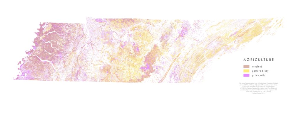
©The Land Trust for Tennessee
Historically, map-making required a set of highly specialized skills held by few – yet advancements in technology and information are allowing more organizations to make leaps and bounds in their work that previously would have taken months (if not years) and a much bigger budget.
Your support powers our work from start to finish, from the first conversation with a landowner to visiting their land every year to ensure its conservation values are protected. Please consider a gift to support conservation in both our communities and wild, open spaces across Tennessee.